Kamis, 28 November 2013


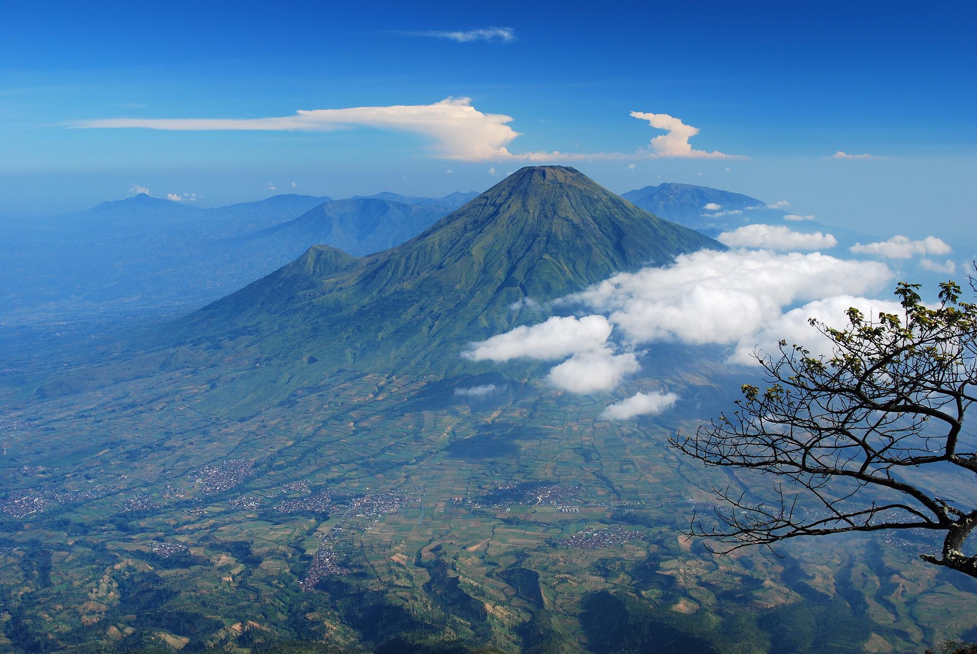
Lawu ( 3,265 m ) is located on the island of Java , Indonesia , precisely on the border of Central Java and East Java . Status of this mountain is a volcano " break " and have not been active , visible from the meeting of vegetation and eroded its peak . On the slopes there is a small crater that still emit water vapor ( fumaroles ) and sulfur ( solfatara ) . Lawu have Dipterokarp forest hill , forest Dipterokarp Top , Montane forest , and forest Ericaceous . Lawu is the source of inspiration of the name Argo Lawu train , railroad executives who serve the Solo Racing - Gambir .

Lawu has three peaks , Hargo Dalem , Hargo Dumiling and Hargo Dumilah . The latter is the highest peak .

On the slopes of this mountain there are a number of places are popular as tourist destinations , particularly in the area Tawangmangu , Cemorosewu , and Sarangan . Slightly downward , on the west side there are two complex enshrinement of late Majapahit : Sukuh and Cetho . At the foot of the mountain is also located relatives Praja Mangkunagaran cemetery Astana and Astana Girilayu Mangadeg . This complex is located near Astana Giribangun , a family mausoleum for the second Indonesian president , Suharto .


Mount Sindara, commonly called Sindoro, or also Sundoro (altitude 3,150 meters above sea level) is an active volcano mountain located in Central Java, Indonesia, with the nearby town of Waterford. Mount Sindara located side by side with a mountain cleft.

Craters that can be found in the ravine along the northwest side of the mountain to the south, and the largest is called Kembang. A small lava dome occupies the summit of the volcano. History Sindara eruption that has occurred mostly mild to moderate type (phreatic eruptions).

Forests in the region of Mount Sundoro have Dipterokarp Hill forest type, forest Dipterokarp Top, Montane forest, and forest Ericaceous or mountain forest.

Rabu, 27 November 2013


 Sumbing, including high mountain located between Java in the Waterford area and Wonosobo, Central Java stands proudly alongside Sindoro mountain side. This strato-altitude mountain bertype 3,371 masl, while the peak condition consists of towering rock cliffs surrounded by craters - a small crater sulfur fumes spread. Sumbing peak consists of two peaks, peak andes, with an altitude of 3,362 meters above sea level and the summit crater, with an altitude of 3,372 meters above sea level


Mount Merapi,Gunung Merapi (literally Fire Mountain in Indonesian/Javanese), is an active stratovolcano located on the border between Central Java and Yogyakarta, Indonesia. It is the most active volcano in Indonesia and has erupted regularly since 1548. It is located approximately 28 kilometres (17 mi) north of the large Yogyakarta city, and thousands of people live on the flanks of the volcano, with villages as high as 1,700 metres (5,600 ft) above sea level.

Smoke can be seen emerging from the mountaintop at least 300 days a year, and several eruptions have caused fatalities. Pyroclastic flow from a large explosion killed 27 people on 22 November in 1994, mostly in the town of Muntilan, west of the volcano.[2] Another large eruption occurred in 2006, shortly before the Yogyakarta earthquake. In light of the hazards that Merapi poses to populated areas, it has been designated as one of the Decade Volcanoes.
                Merbabu is of type Strato volcanoes ( see Volcanic ) is geographically located at 7.5 ° S and 110.4 ° ​​East . Administratively the mountain is located in Magelang district on the western slopes and slope Boyolali in east and south , Salatiga and Semarang district on the slopes north , Central Java Province .Merbabu known through the texts of the pre - Islamic as Damalung Mount or Mount Pam ( a) Rihan . On the slopes there are never known and never visited the hermitage by Manik Bujangga the 15th century . Etymologically , " merbabu " is derived from the combination of the words " Meru " ( mountain ) and " gray " ( gray ) . The new name appears in the records of the Netherlands .The mountain erupted in 1560 and 1797. Reported also erupted in 1570 , but has not made ​​a confirmation and further research . Merbabu mountain peak at an altitude of 3,145 meters above sea level .Merbabu have Dipterokarp Forest Hill neighborhood , Forest Dipterokarp Top , Montane forest , and forest Ericaceous or mountain forest .

 
Copyright (c) 2010 Mountain Lovers. Design by WPThemes Expert

Themes By Buy My Themes and Top VPS Hosting.